

Lot 2218 60.00 EUR
(sold)
Russia

60.00 EUR
(sold)
[{"image":"https:\/\/cdn.philasearch.com\/A09087\/E22213\/2221300019.jpg","thumb":"https:\/\/cdn.philasearch.com\/A09087\/E22213\/2221300019.jpg"},{"image":"https:\/\/cdn.philasearch.com\/A09087\/E22213\/2221300019a.jpg","thumb":"https:\/\/cdn.philasearch.com\/A09087\/E22213\/2221300019a.jpg"}]
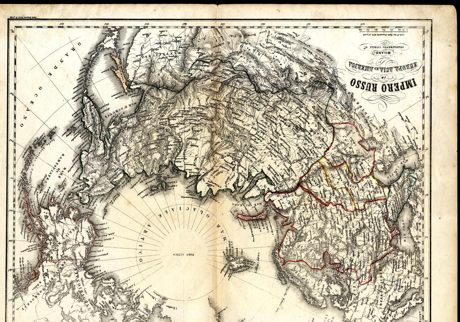
1860 (ca.), zwei teils kolorierte Landkarten von südlichen Teil des
europäischen Russlands bzw. von Gesamtrusslands (noch mit Alaska,
das 1867 an die USA verkauft wurde), gedruckt vom Stabilimento
Civelli, Milano, die erste Karte mit einem gebräunten
Mittelstreifen und unten etwas eingerissen, die zweite Karte
einwandfrei
Automatically generated translation:
1860 (approximate. ), two partly coloured maps from southern part of the European Russia respectively from Gesamtrusslands (still with Alaska, the 1867 to the USA sold became), printed from Stabilimento Civelli, Milan, the first card with a toned median and at the bottom slightly worn, the second card perfect
